|
|
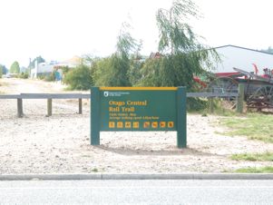
February 21 & 22. The big walk.
Alexandra to Oturehua (by car).
Oturehua to Alexandra (on foot)
Where to begin? Perhaps at the end, this being a dramatic technique often
featured in modern literature. At 5.00 pm on Tuesday 22 February 2005,
I staggered into the Shell service station on Tarbert Rd, Alexandra, purchased
a 2 litre container of milk from the chiller and, in front of the worried
gaze of the girl at the counter, sank about half of it at one go.
While
she was outside serving a customer, I changed from my formerly white shirt
(now largely stained brown with the colour leached out of my leather belt),
into something cleaner & slumped onto the floor, leaning against a freezer
full of fish bait.
From there I used my mobile phone to contact the motel & ask the lady
if she would come and collect me. She was there within 5 minutes, took
one look at me and suggested that perhaps we should return via the hospital.
|
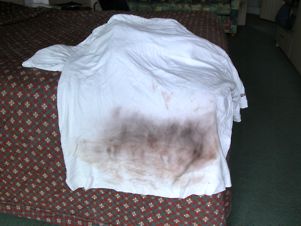 |
The grubby aftermath
|
The epic commenced on a cool and cloudy Monday morning when, after a large
bacon sandwich and, fortunately, the manufacture of a ham sandwich solely
because I feared that the ham might go off if I didn’t use it, I completed
packing my backpack and walked across the road to the bike shop. They organise
bike tours on the Rail Tail and it was possible that they would have been
able to collect me from wherever I reached the following day. Alas, they
had no trips planned so couldn’t help.
 |
I then made the best decision I have made for many a long year & asked
to take up the motel’s offer of a lift to wherever I wished to go. I decided
that it would be simplest if they took me to the furthest point that I
might reach & I could then walk back home. This meant, although I didn’t
realise it at the time, that I would be walking down a series of considerable
hills – about the maximum that a normal train can manage.
In the light
of later events, this probably saved me from having to be rescued by the
emergency services or any other Good Samaritan that I could find.
|
A cool and cloudy morning
|
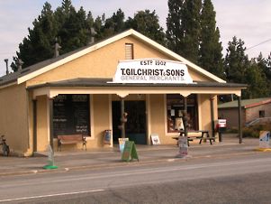
My lift took me to the village of Oturehua, where I unloaded my belongings,
and agreed that I would ring back to the motel if I struck problems or
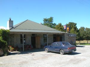
needed another lift home. The village has a Victorian shop, which has been
little altered since it was built. I went in to buy a drink and then crossed
the road to find the walk which starts at the back of the pub.
 |
 |
Gilchrist's Store, Oturehua
|
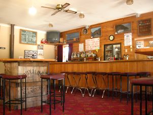
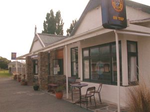
Oturehua pub
|
 |
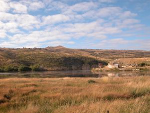
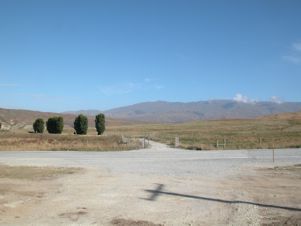
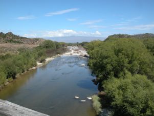
Above: Oturehua hauliers yard and the start of the walk
Left: Idaburn Dam
|
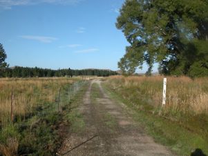
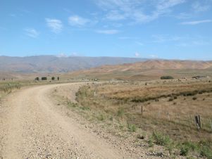
Oturehua - the walk begins
|
 |
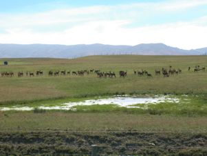
It was still cloudy and I was able to start off wearing a tracksuit top.
The trail passes close by the Idaburn Dam, which is used for curling when
the conditions permit.
 |
 |
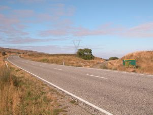
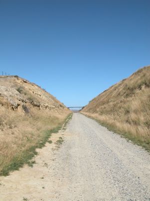
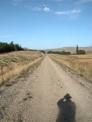
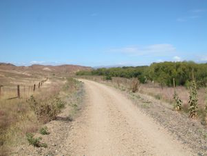
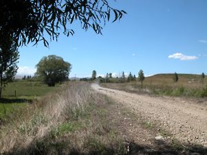
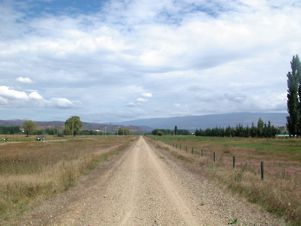
The trail follows the road ...
|
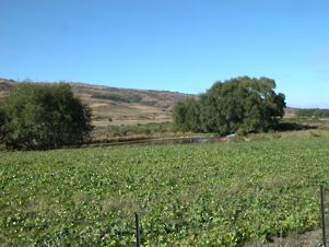
... and through some vegetable fields
|
It runs through some well irrigated vegetable fields, following the road
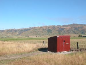
for quite a while. Being a railway line it is, of course, very straight.
There are some reminders of the old railway, with some of the old track
side huts having been painted a lurid red.
 |
 |
The path was very straight
|
Past a colourful hut
|
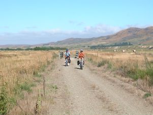
After about an hour, I met my first other people. I was surprised that
the trail remained so quiet throughout my journey although, given the state
I finished in, perhaps I shouldn’t have been so surprised!
 |
 |
Company at last
|
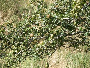
Fruit trees along the line
|
The guide book records that there are many fruit trees along the trail,
these being the result of apple cores etc being thrown out of the train
windows by passengers in years gone by. I saw lots of apple trees, a couple
of pears and one plum.
They all looked healthy and almost all heavily laden with fruit. The local
soil must suit them well. There was quite a lot of water in evidence on
this section of the trail and lots of shelter from trailside trees.
Ida Valley station came and went – with the emphasis on the went as there
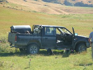
isn’t anything there. I came across some farm workers with a ute and lots
of dogs, obviously preparing to muster sheep or cattle.
 |
 |
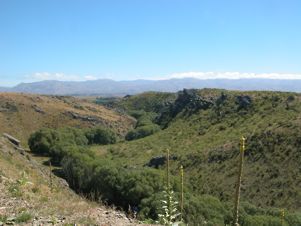
The Ida Valley
|
Along the
Raggedy Range
|
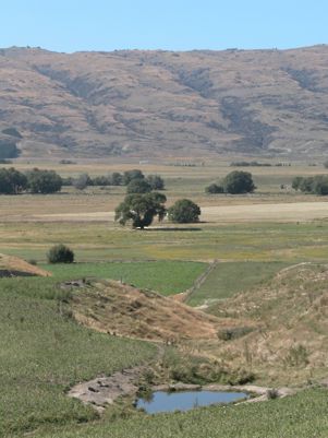
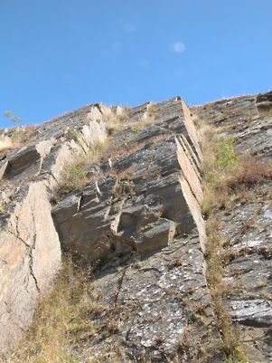
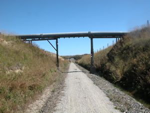
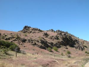
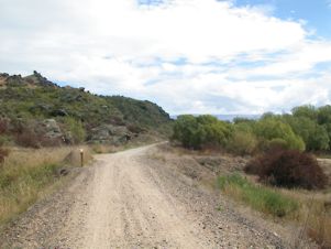
At this stage, the trail started to rise steadily as it climbs from the
Ida Valley up the side of the Raggedy Range.
There are a number of cuttings through the rocky outcrops and, in some
cases, pipelines running across them. By now the shade had reduced to a
minimum and the sun was high in the sky. I had to pack the tracksuit top
away but was making good progress at just under 5 kph.
 |
 |
A day's work for a dog
|
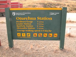
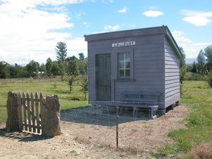
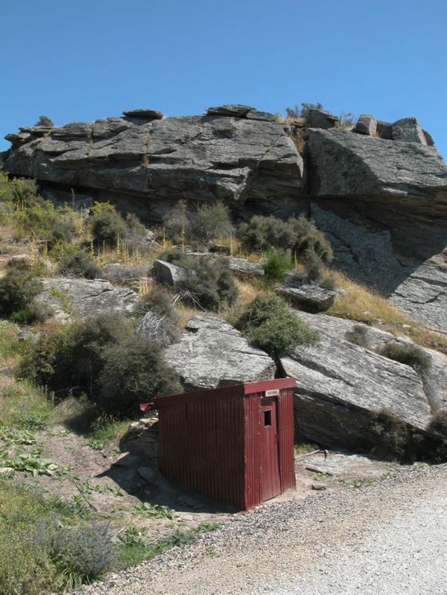
Auripo Station
|
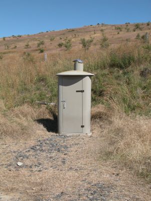
Auripo Station is in the middle of nowhere, opened in 1904 with a passenger
shelter and a loading bank. A quarter of an hour later is the Thurlow Rd
car park, which is just a car park and a Department of Conservation long
drop toilet.
 |
 |
Thurlowe Rd toilet
|
Through the cutting
|
This is the first section of the trail as defined in the guidebook and
I had covered the 13k in good time, about 15 minutes less than the book
suggested.
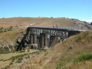
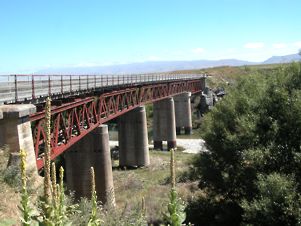
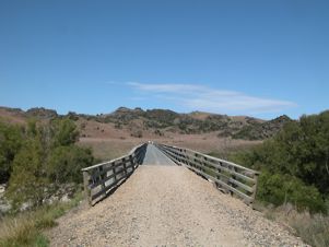
Poolburn Viaduct
|
The landscape was becoming increasingly rugged as the trail rose up the
side of the valley and passed through a deep cutting into the Poolburn
Gorge.
The river is crossed on a high viaduct, 37 metres high and 108 metres long,
which was built between 1901 and 1904. I met a couple of European cyclists
on it taking lots of photos.
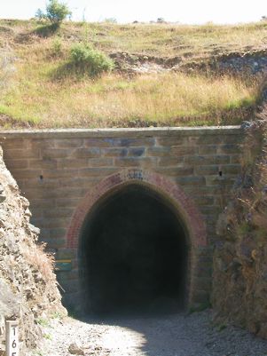
After rounding a bend, the trail passes through two tunnels. The first
one is about 200 metres long and the other slightly longer. Both are curved
so that there is no continuous light.
|
 |
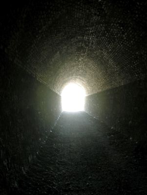 |
Poolburn No 1 Tunnel
|
Poolburn No 1 Tunnel
|
The guide book says that walking through them, particularly on your own
and without a torch, requires considerable courage. As a complete wimp
who did exactly that, all I can say is “rubbish”. There are many worse
experiences on the trail, as I was eventually to discover.
From there it is gently down hill all the way to Lauder. The greeting to
the village is one of the most alarming that I have met – a sign saying
“Caution. Lauder Gun Club ahead”.
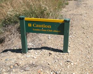 |
 |
Beware dangerous Gun Clubs
|
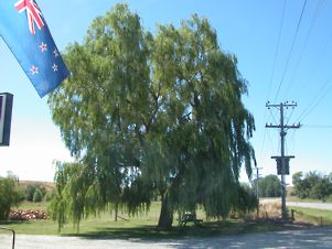
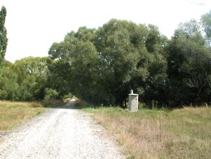
Convenient weeping willow
|
It is difficult to know if they are lousy shots or likely to foment a revolution.
On the old station platform is a DOC water tap, bearing the warning that
the water may or may not be fit to drink and that it may be wise to boil
it. This is extremely useful but, as I was within 100 metres of the pub,
I wasn’t too concerned.
Alas the door was locked and the notice on it said that on Mondays only,
they wouldn’t open until 3.00. It being 2.30, I decided that there was
no option but to sit in the shade, firstly of the pub porch and then on
the bench under the weeping willow by the front door.
I ate the last half of my sandwich while I waited. On the dot of 3.00,
the door opened and I drank 2 pints of NZ beer (albeit with a dash of lemonade).
I did this with more enthusiasm than ever before in my life and, I suspect,
than ever I will again. I suspect that sports medicine specialists will
decry the use of lager shandy as a rehydration tool but, on this occasion,
it worked very well.
|
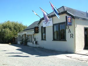 |
Lauder Hotel
|
Suitably fortified, I set off again on one of the shorter legs of the
journey, down more straight trail, past some swampy bits, under another
pipeline ...
 |
 |
Small bridges as well as large ones
|
Swampy bits
|
 |
 |
Under another pipeline
|
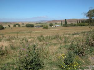
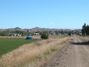
... and into sight of Oamakau
|
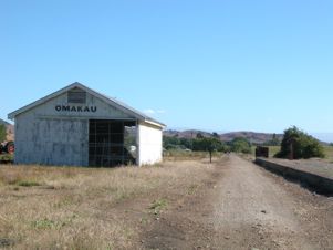
… and into sight of Omakau, my destination for the night.
My feet were beginning to hurt but all was well as I passed the stock yards
and entered the station. I then had about another kilometre of slightly
uphill walk to reach the lodge where I was staying. This was hard work
being so near and yet so far.
When I arrived there, I was obvious that it was worth the walk. The place
is magnificent, just as well equipped as the 5 star hotel in which I stayed
in Sydney last year.
Right:
Oamakau Station |
 |
|
|
|
 |
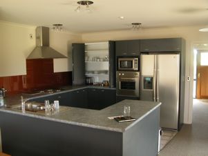 |
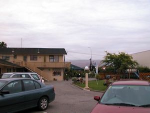
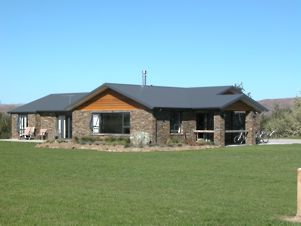
Tiger Hill Lodge, Oamakau
|
I had to walk next door to announce my arrival to the owner who promptly
showed me how to use the ice and iced water making machine in the kitchen.
Removing my shoes revealed some nasty blisters but a shower and a change
of clothes put everything else right. I then met some of my fellow guests,
watched some of the TV news with them and we walked (I staggered) the kilometre
or so down to the village pub for dinner. There I met the others.
The couple I walked with were about 40 and from North Canterbury. She ran
the breast screening unit for the top end of the South Island and he ran
safety training courses for farm bike users. They were slightly “proper”
but very nice. Once at the pub, we met the other party of four. They were
blokes, also about 40, who had left their loved ones at home in Auckland
and come away for a week’s drinking & cycling. Upon discovering the trade
of the lady in the party they expressed their enthusiasm for scanning breasts
& then one of them asked if she knew the NZ head of the whole organisation
who was a friend of his & with whom he had just flown down to Queenstown,
the starting point of their holiday. This broke the ice a little! He was
in commercial property, one of the others was a stone mason, who owned
the company which had done the work at the Craggy Range winery in Hawkes
Bay, a magnificent building which I visited a few months ago. They were
all trying to let their hair down and have a good time while they could.
All six were on mountain bikes.
Above: The return from the pub
|
The pub, we discovered, is owned by a young couple, who couldn’t be
as young as they looked. They had had the place for a year, were
making a profit and working very hard. It was nice to see something
like that paying off. We persuaded them to open the posh restaurant
for us, which they did & settled down for a very good meal. The couple from Canterbury didn’t
drink much but the “lads” ordered one bottle on the advice of the chef/landlord,
which we agreed was rubbish, slightly upsetting mine host, ordered something
else at his suggestion (Dry Gully pinot noir) which we agreed was very
good & ordered several more bottles.
|
I wasn’t allowed to pay for any of
the wine which was slightly embarrassing and I was even given some more
when we returned to the lodge.
The lady who owned the lodge, which opened in December, had originally
planned a back packers’ hostel but one of the cycling tour companies persuaded
her to look at the other end of the market as increasing numbers of middle
aged and relatively well moneyed people were doing the trail and were looking
for something a bit better than country pubs or backpackers accommodation.
So far as we were all concerned, it was an excellent idea and it is to
be hoped that it is successful enough to encourage others to do the same
on other parts of the trail.
The early morning was enlivened by the sound of water flying around. I
assumed that either it was raining (would that it had been) or that someone
was having a shower at a ridiculous hour. It turned out to be the automatic
sprinklers coming on in the garden. Breakfast was toast, home made apricot
jam, home stewed apricots & peaches and coffee. I packed up, wandered next
door to pay my bill and set off along the trail.
Day one was hard work but enjoyable. Day two was a trifle frightening and,
almost literally, a battle for survival. My feet hurt a lot but everything
else seemed to be functioning normally so I clenched my teeth, established
a rhythm and made a good pace.
To begin with, the trail rose gently but then fell away and went downhill
almost all the way to the finish. The cloud burned off much earlier than
yesterday and the sun was hot.
 |
 |
The start of Day 2
|
 |
The hot sun begins
|
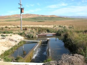
Interesting water race
|
I crossed another large bridge, found some interesting water races and
was watched by some interested spectators. Being dependant on a steady
rhythm to take my mind off my feet, having to stop for gates was a trifle
annoying but there were several of them, normally marking farm boundaries.
Shade was very scarce and the sun was beating hard into the back of my
neck. Even my wide brimmed hat didn’t offer too much protection.
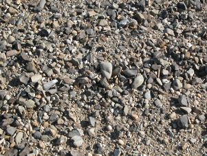
One of the reasons for the state of my feet was the composition of the
trail’s surface. It was compressed gravel, no harder than the average pavement,
but the loose stones made for a very uneven and uncomfortable surface upon
which to walk.
 |
 |
Uncomfortable surface
|
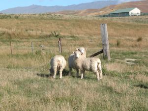
Interested spectators
|
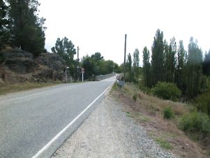
Eventually, I reached Tiger Hill, probably the steepest section on the
trail. It sweeps down the hill in wide curves to keep the gradient to a
minimum, crossing the road a number of times.
I eventually decided to follow the road for the last stretch into Chatto
Creek as it would cut several hundred metres off the walk.
 |
 |
Tiger Hill
|
The trail crosses the road
|
From here on, things became a little hazy. I left the pub at 12.00. By
13.00 I was feeling both a bit dizzy and a bit nauseous. It was very hot,
there was no shade and I knew that I needed far more water to survive the
last 18k than I could carry with me.
 |
 |
No shade in sight
|
The countryside became very rugged
|
 |
 |
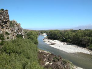
Manuherikia River
|
Manuherikia River No 2 Bridge
|
I staggered on a step at a time, taking brief rests whenever I could find
some shade. The countryside became very rugged until we met the Manuherikia
River again.
This, unfortunately enough, ran a few hundred metres to the right of the
trail so that there was no shade from the trees which lined its banks.
I feared that if I climbed down to the river, I might not be able to climb
back up to the trail again.
I managed to lose the dizziness for a while, although this had had the
benefit of deadening the pain from my feet. My stride was becoming shorter
and shorter and every step was becoming harder and harder.
I suspect that the temperature was pushing 40, with its heat being magnified
upwards by the pebbles on the trail – just the reason why grapes grow well
on stony ground. Unfortunately, I’m not a grape vine. The temperature in
town that afternoon was 32 and away from the Clutha River and in the open
sun, it will have been much higher. I knew that the only thing was to keep
on going slowly, resting in the odd patches of shade that presented themselves
– every two or three kilometres!
 |
 |
A small amount of shade
|
Galloway Flat
|
Eventually I reached Galloway Flat, an area which is being developed as
lifestyle blocks. The heat was intense, there was no shade and the trail
appeared to go on and on and on, which is what I did. The old station actually
offered a bench in the shade, of which I took full advantage. Opposite
it is a mound of rocks, some pretty flowers and a sign about lizards. I
wasn’t in a fit state to read it. I started to meet school buses, discharging
their load of children into the cars of waiting parents. The urge to ask
one of them for a lift or even a glass of water was very strong – but I
resisted it. They would probably have called the police - or the local
mental hospital!
 |
 |
Galloway Station
|
Shade by the toilet
|
After about 5k, the Flat ended, and there was another DOC toilet with some
trees around it. I lay down for a while, had the penultimate slurp of my
water and then lurched to my feet and set off on the last three kilometres.
These took me as long as six had done earlier in the day but I started
to regain hope when I saw people from Alexandra out for a late afternoon’s
walk.
At long last, there was a gentle breeze blowing. The down side was that
it was blowing into my face. Whilst it was now cooler, walking was even
harder work.
The land had become very rugged again and I saw a number of horribly fit
runners charging up and down the slopes. Eventually I met an oldish lady
who assured me that it had just taken her 10 minutes to walk from the end
of the trail. I now knew that I could do it.
After 8 minutes I rounded
a corner and saw the trail come abruptly to an end, join the road and cross
a bridge over the river. There was a wooden barrier at the end of the trail
and I used it as a seat whilst steeling myself for the last few hundred
metres.
|
 |
Rugged country again
|
 |
 |
The rail trail joined the road ...
|
... and came to an end
|
Once on the road, I passed a couple of girls, each carrying a bottle of
water in one hand and an ice lolly in the other. I nearly mugged them.
Another hundred metres along the side road and then about three hundred
more down the main road took me to the petrol station, which is where this
essay started. The guide book estimated 4 hours for the 17k. It took me
5. On all the other legs I had travelled faster than the guide book.
My trip back to the motel took no time at all and I had soon finished the
container of milk. The lady from the motel fussed around me and made sure
that I wasn’t about to expire. She told me that she had had one of her
staff on standby all afternoon in case I had rung for help and was getting
worried when she didn’t hear. The milk was, by now, acting as a mixed blessing.
I was still very hot and the contents of my stomach was very cold. I started
to shiver and this didn’t stop until I had had a hot shower & a cup of
warm tea. I then lay down & dozed for about an hour.
My feet were very sore so I was given one of the small electric foot spas.
This was great and improved things considerably. I carried on drinking,
managed to eat a couple of peaches & went to bed, getting up a bit later
to have more drinks, a slice of cheese, a lump of rookworst and a couple
of anti-inflammatories.
A bad day was over – but I had finished the walk that I had planned. Longer
than the plan, in fact, as the original 50k had expanded to about 65. I
hadn’t needed to summon assistance and I was still alive. Older but wiser
as they say. Next time I do some of the rail trail it will be at a much
cooler time of year.
 |
Poolburn Gorge
|
|