| Go forward to Paremata road bridge | ||||
|
||||
| Turn left to face Half way down the steps running from Doon Grove to Papakowhai Rd | Turn right to face Doon Grove looking South East | |||
| Turn back to face Doon Grove | ||||
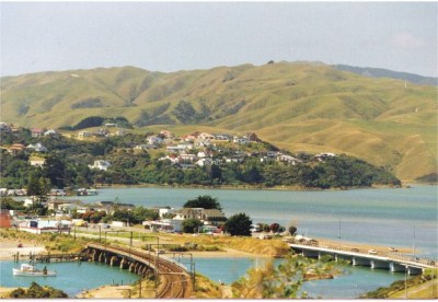
View from Doon Grove looking over the Pauatahanui Inlet towards Camborne. The road and rail bridges are in the foreground.
Doon Grove was first opened up for housing development in the 1960s. By the standards of the area, it is now "mature"
View Doon Grove, Papakowhai from all angles
Home Page · Where is Papakowhai, Paremata & Plimmerton? · Site Map · Acknowledgements · Contact
© Copyright Meyricke Serjeantson 2002. Last updated 15 December 2002.
Created using Touroid Virtual Tour Creator
![]()